.png)
How National Storage manages 200+ sites with digital building data
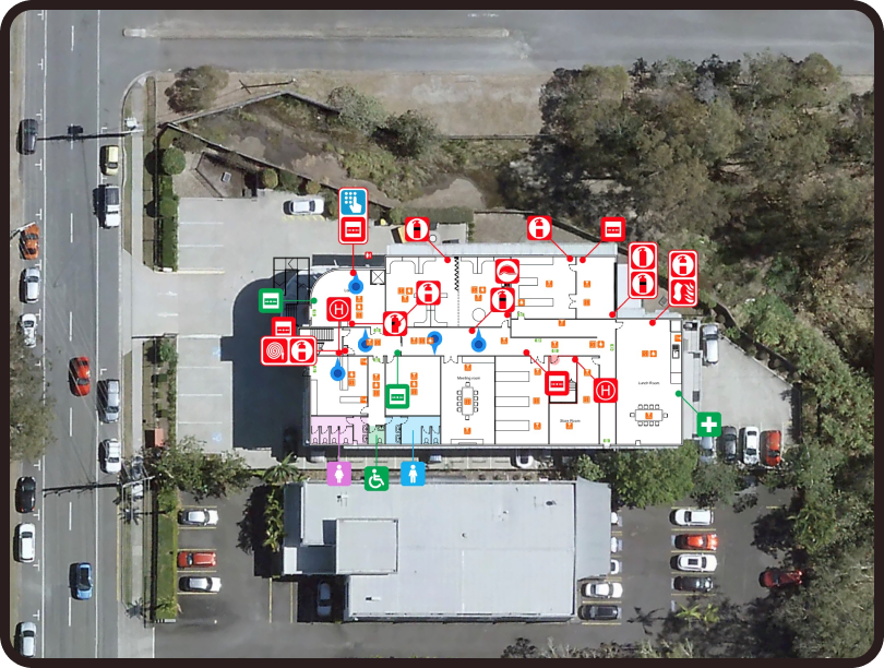
National Storage uses PlanStudio® to maintain spatially accurate floor plans and interactive site maps across more than 200 facilities in Australia and New Zealand.
About National Storage
National Storage is one of Australasia’s largest self-storage providers, operating more than 200 facilities across Australia and New Zealand.As the business continued to expand, managing consistent and accurate building floor plans across such a large portfolio became increasingly complex. Each facility contains hundreds of storage units, making precise spatial information essential for site management, customer navigation and operational planning.
In addition, growing customer demand for contactless services and digital self-service experiences created new expectations around how customers locate and access their storage units.
National Storage needed a more scalable way to manage building floor plans across their network while also supporting new digital experiences for customers.
Managing building data across 200+ sites
Before adopting PlanStudio®, National Storage faced several operational challenges related to building and site data:
- Inconsistent floor plans across more than 200 facilities.
- Difficulty maintaining accurate records of building layouts and storage units.
- Limited ability to provide digital wayfinding for customers navigating large sites.
- No centralised system for managing interactive site maps and building data.
As the organisation continued to grow, maintaining accurate spatial information across multiple locations became increasingly difficult.
National Storage required a system capable of standardising digital floor plans and supporting interactive building maps across their entire portfolio.
“The need quickly went from accessing basic map technologies to being able to harness all that could be offered with PlanStudio®. Not only do we get maps of all 200+ of National Storage’s sites, but these maps are interactive, accurate and easily accessed and maintained by National Storage. This gives us control over our own building data and allows us to use the information for many purposes, including asset unit management, fire and evacuation maps and way finding to storage units.”

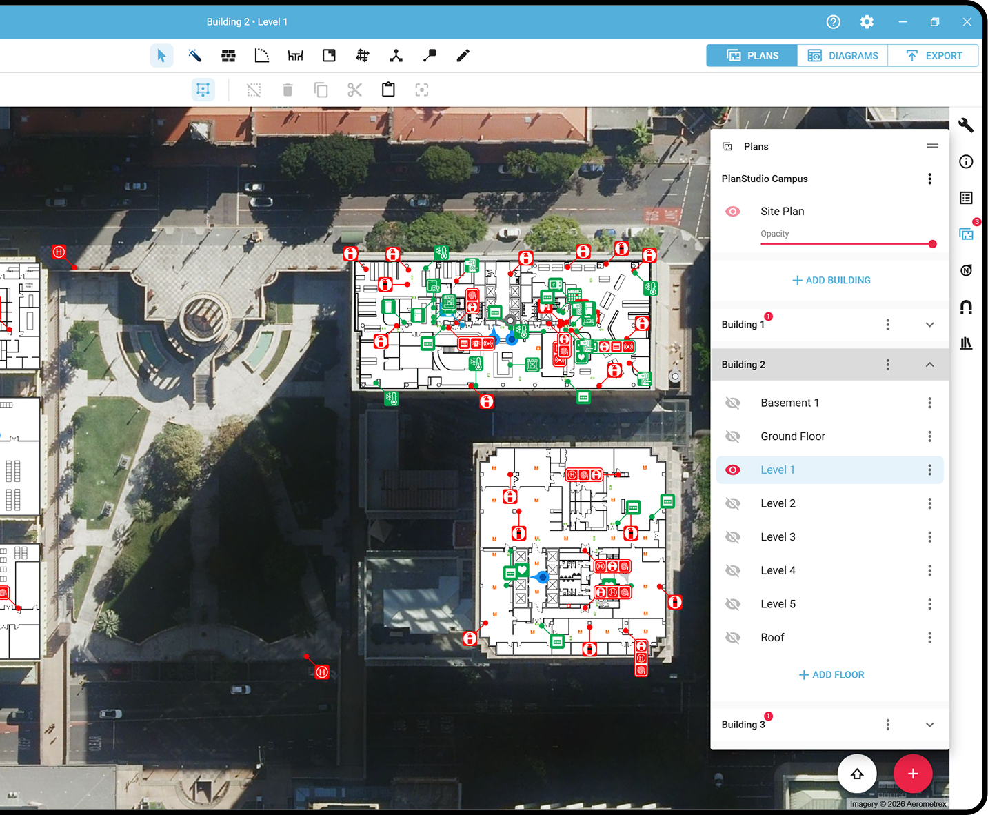
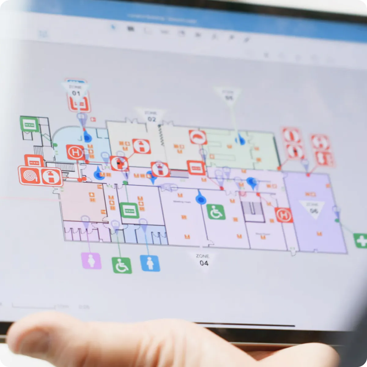
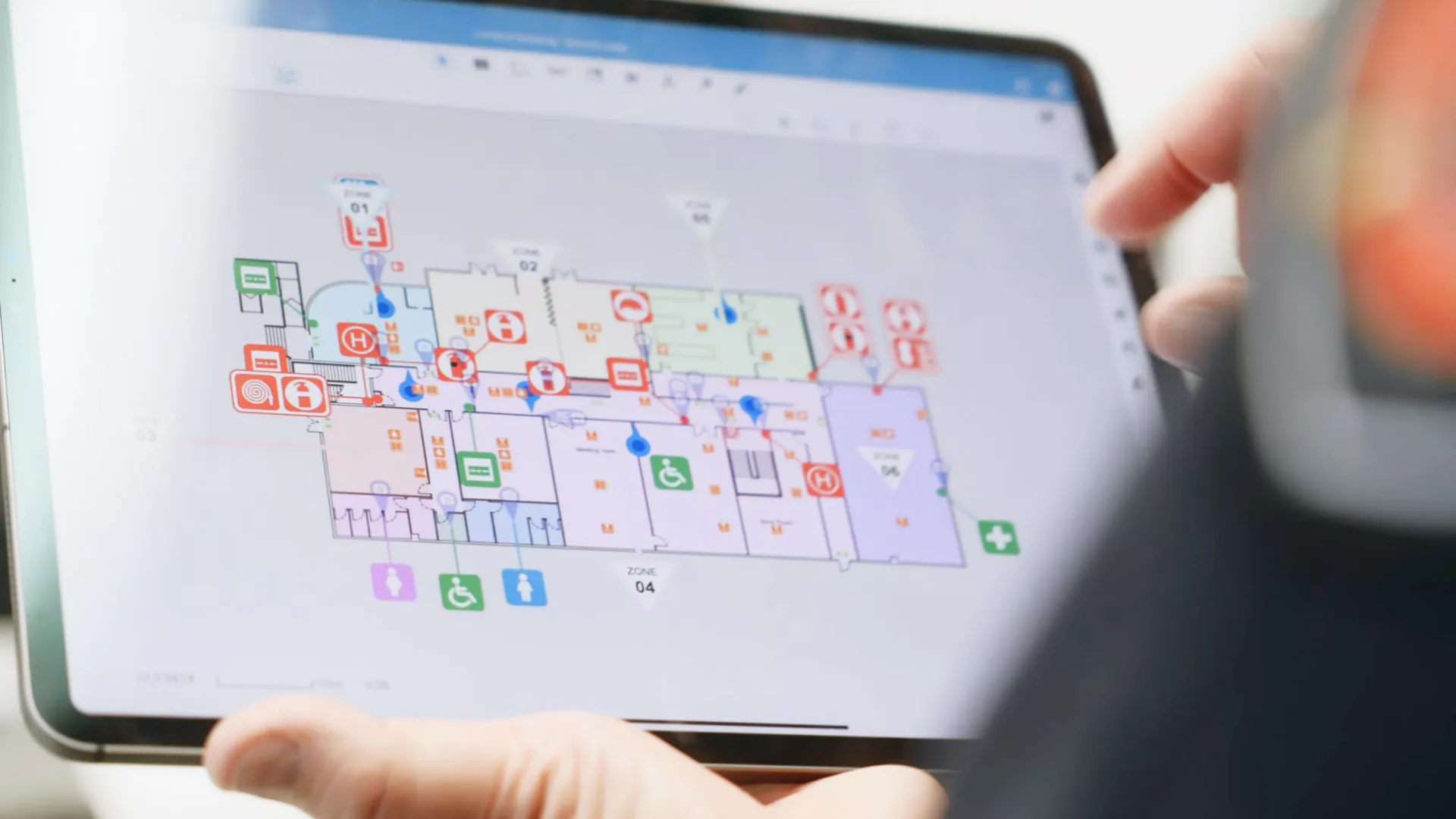
A centralised platform for digital floor plans
Working closely with National Storage, Locatrix implemented PlanStudio®, using its API integration to enable interactive site maps across the company’s digital platforms.
Through this integration, National Storage was able to embed a customisable plan viewer into their website using JavaScript. The system allows floor plans to load dynamically while enabling the organisation to create tailored customer experiences around navigation and site information.
With PlanStudio®, National Storage can now:
- Maintain accurate digital floor plans across 200+ facilities.
- Provide interactive maps for customers and staff.
- Support wayfinding to individual storage units.
- Manage building data centrally while retaining full control of their information.
- Use spatial data for additional operational purposes including asset management, evacuation planning and facility navigation.
This flexible system allows National Storage to continuously expand how building data supports both operational workflows and customer experiences.
“Unit and centre navigation is a critical factor in this business. PlanStudio®’s interactive floor plans make this an effortless process and gives us reassurance we’re providing our customers and staff with a much more efficient way of doing so. Not only has PlanStudio® helped us offer our customers a better move in experience, but it has enhanced their safety inside and outside business hours.”
Consistent building data across every facility
By mapping every facility within PlanStudio®, National Storage now has a consistent digital system for managing building layouts and storage units across its entire portfolio.
Key outcomes include:
- Interactive floor plans across 200+ sites.
- Improved wayfinding for customers navigating large storage facilities.
- Accurate mapping of individual storage units and assets.
- Greater visibility and control over building data and spatial information.
This digital foundation allows National Storage to use their building data for multiple purposes, from customer navigation and operational management to fire safety and evacuation planning.
200+
Sites managed
PlanStudio® at a glance
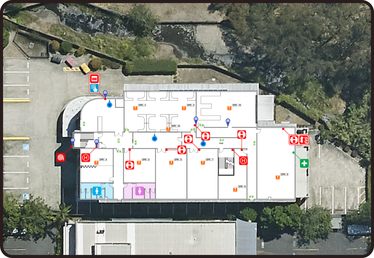
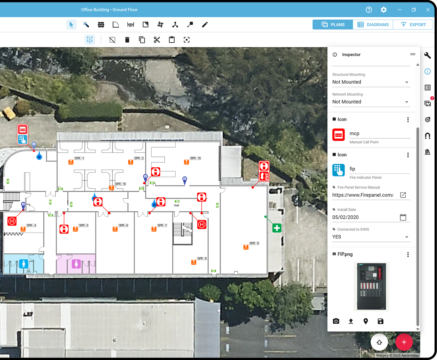
Draft, edit and publish spatially accurate floor plans, with instant evacuation sign generation and secure cloud storage built in.
Locate assets
PlanStudio® can be used for wayfinding and supporting contractors in finding and maintaining site assets faster.
Compliance
Standardise evacuation diagrams to meet regulatory requirements with built-in structure and consistency.
Multi-site management
PlanStudio® is designed for managing multiple buildings. Manage 200+ sites floor plans from one solution.
Evacuation signs
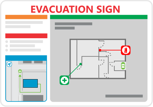
Generate compliant evacuation diagrams instantly – ready for publishing and installation. Eliminating compliance gaps.
Active users generate 120+ signs per month.
Emergency preparedness starts with accurate building data
PlanStudio® gives organisations a simpler way to create and maintain compliant evacuation diagrams, safety plans and building floor plans used for emergency preparedness and fire safety compliance.
Built specifically for building safety and compliance workflows, it replaces complex drafting tools with a streamlined system designed for accurate floor plans, standardised diagrams and faster updates across sites.
Create and maintain compliant evacuation diagrams faster
Standardise floor plans and safety diagrams across sites
Keep building safety information accurate and accessible
Numbers that matter
Locatrix supports organisations across drafting, training and emergency response. These numbers reflect real buildings, real teams and real operational outcomes.
139K+
Active building floor plans
778K+
People trained
173M+
Square metres mapped
Ready to build better plans?
See how PlanStudio® works for your team in minutes.