.png)
ESP
Our Emergency Services Platform (ESP) delivers critical building information to first responders – when and where it matters most.
ESP
Share real-time building information with first responders to support faster, safer decisions.
Real-time building intelligence
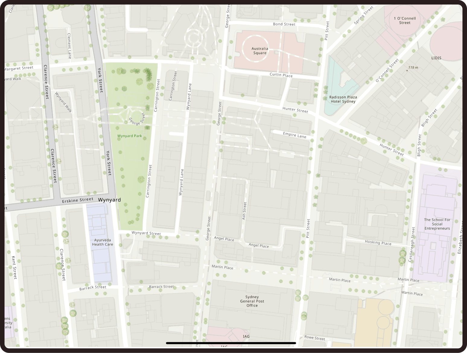
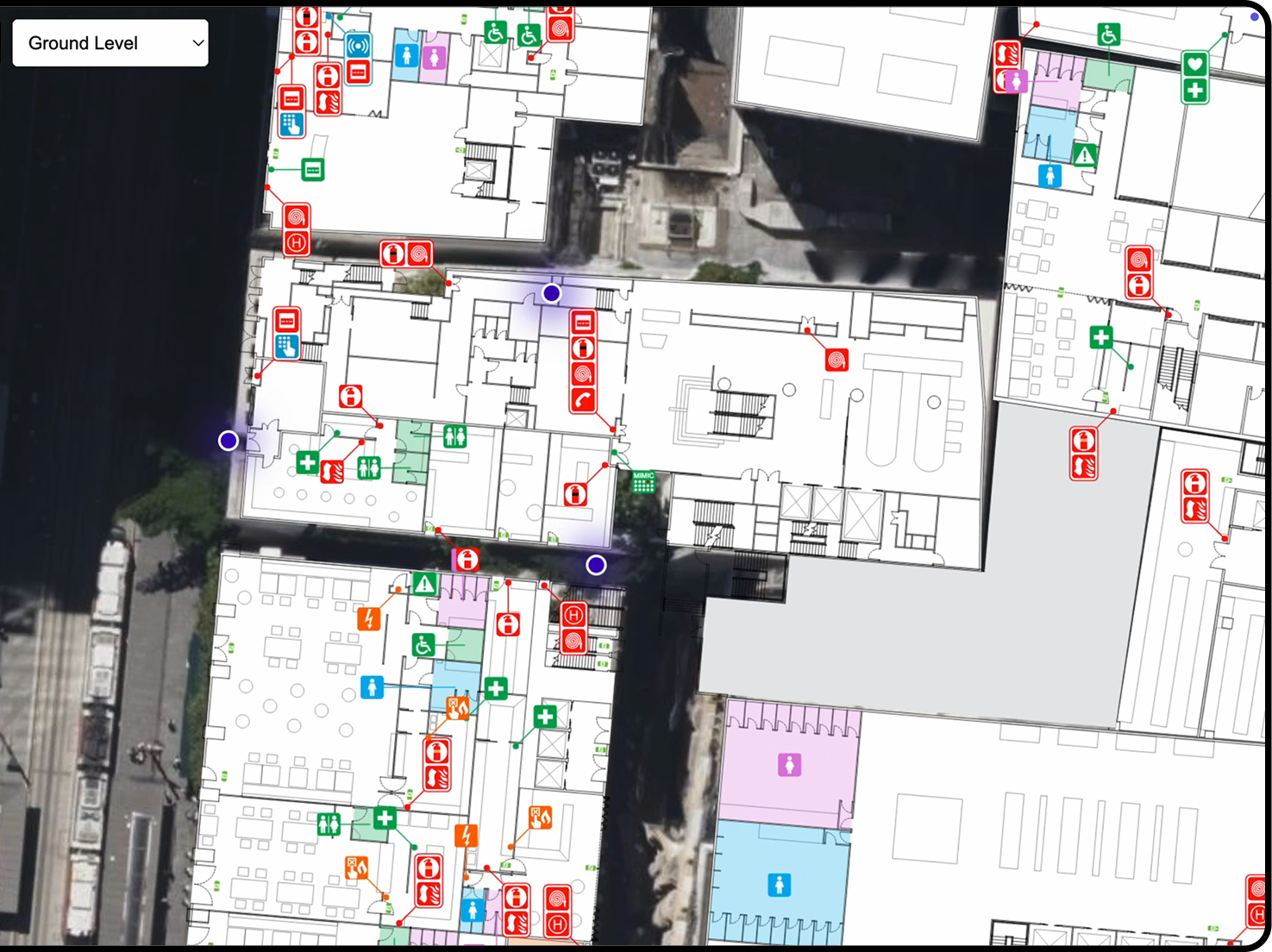
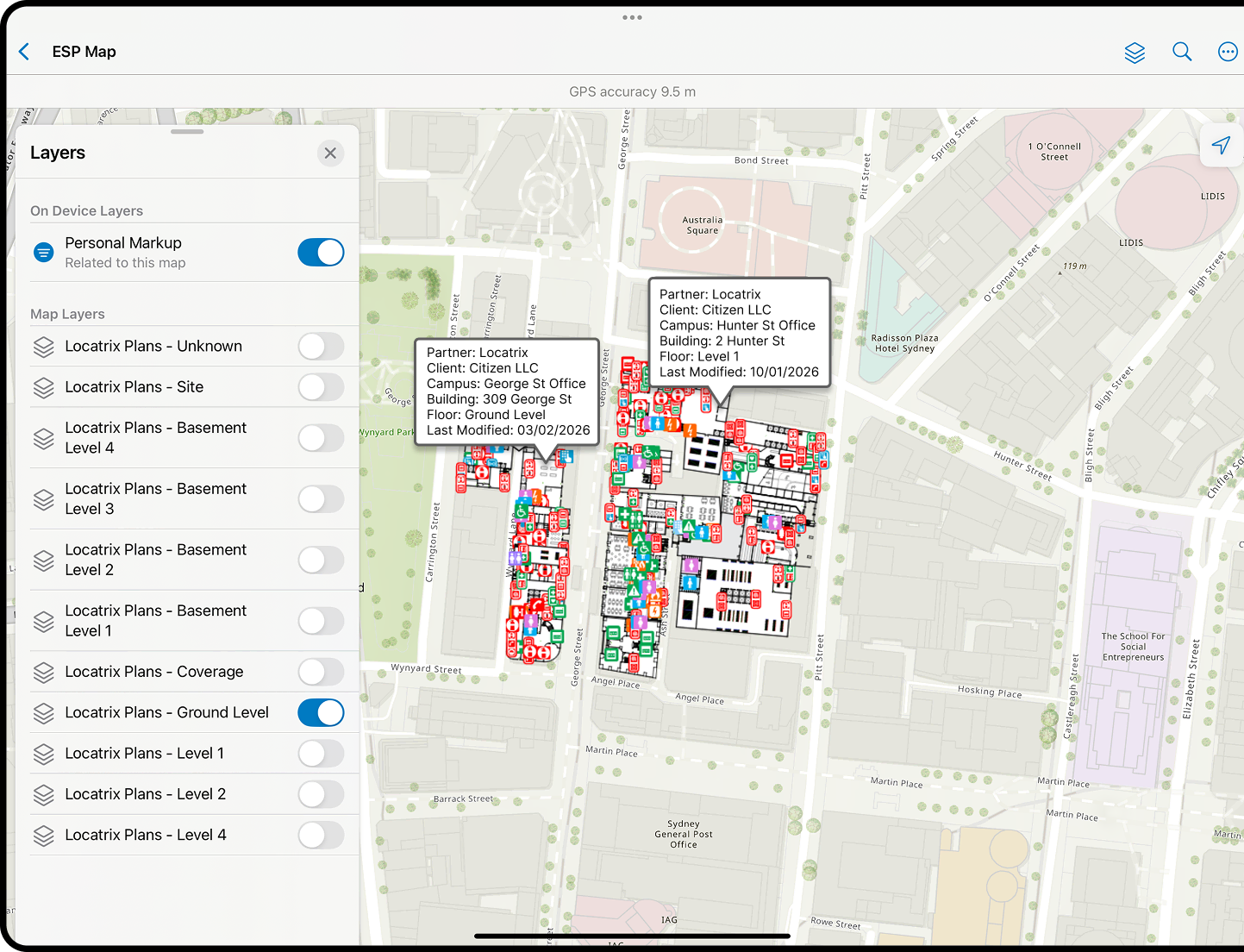
Provide first responders with access to up-to-date digital floor plans and critical building information before and during an incident. ESP ensures the data shared reflects the current layout and asset configuration – reducing uncertainty and supporting faster, more informed decision-making on arrival.

Integrated first responder workflows
Connect building data directly into existing responder systems and operational planning tools. ESP integrates with established workflows, allowing critical information to be accessed without disrupting response processes or adding complexity in high-pressure situations.
Automated plan currency and compliance
Keep emergency information current through automated updates and structured plan management. ESP helps ensure evacuation diagrams, floor plans and critical building data remain accurate and aligned with regulatory requirements – without relying on manual tracking. You can also turn static diagrams into intelligent building data.
ESP at a glance
The right building information – at the right time.
Reduce risk
Give responders access to accurate, current building information – reducing uncertainty during live incidents.
Enhance situational awareness
Deliver building data directly into responder systems to support faster assessment and coordination.
Visualise critical information
Clear digital floor plans help responders quickly understand layouts, access points and key assets.
Support informed planning
Provide reliable building information for pre-incident planning and ongoing operational reviews.
Built for your environment
Provide first responders with access to up-to-date digital floor plans and critical building information before and during an incident.
Fire
Keep emergency information current through automated updates.
Police
Connect building data directly into existing responder systems. In use with NSW Police.
Ambulance
Reduce uncertainty and support faster, more informed decision-making.
"Locatrix have gone to considerable efforts to provide Emergency Services with indoor maps. This information will prove to be critical over time and will greatly the enhance the situational awareness of responding agencies."


Ready to strengthen emergency response?
See how ESP delivers critical building information when it matters most.
Numbers that matter
Locatrix supports organisations across drafting, training and emergency response. These numbers reflect real buildings, real teams and real operational outcomes.
138K+
Active building floor plans
778K+
People trained
172M+
Square metres mapped
Frequently Asked Questions
Common questions about our Emergency Services Platform.
ESP (Emergency Services Platform) is our cloud-based data-sharing platform from Locatrix that provides first responders (fire, police, ambulance) with instant access to digital floor plans and critical building information during emergencies. Agencies including NSW Police are already working with ESP to support operational preparedness.
It’s a national repository of up-to-date indoor building plans and safety information that integrates with emergency services’ existing systems. The purpose of ESP is to help emergency agencies respond faster and more safely by giving them real-time, geospatially accurate “eyes inside” buildings when seconds count.
It is not a consumer app or a tool that building owners or the general public log into. It’s a backend platform that ensures first responder agencies can get the information they need when and where they need it.
Under the hood, ESP pulls from Locatrix’s extensive database of digital floor plans (created and maintained via PlanStudio®) and makes them available to authorised emergency service agencies.
Rather than being a separate app that first responders have to learn, ESP feeds building plans directly into the mapping and dispatch software first responders already use.
When an emergency call comes through for a specific address, responders can quickly retrieve the building’s floor plan and safety info from ESP through their systems. This seamless integration means first responders don’t need new hardware or logins – the data appears in their existing tools as an added layer of intelligence.
Example: A firefighter en route to a high-rise incident could open their in-vehicle mapping system and immediately see the building’s floor layouts, entry points, fire stairs, and hazard locations, all provided by ESP.
The indoor floor plans and building data in ESP are sourced from Locatrix’s PlanStudio® platform. Every building that has been drawn or uploaded by our customers (or their service providers) into PlanStudio®.
In fact, as of launch, ESP includes over 70,000 Australian buildings (with 134,000+ floors mapped) – one of the most comprehensive indoor spatial datasets in the country. These plans are maintained and updated regularly by Locatrix and our extended network.
This ensures that first responders are accessing the latest available information. If a customer renovates or adds new floor plans to their building, those changes will flow into ESP during the next update cycle.
In an emergency, having immediate access to a building’s layout and safety information can save precious time and lives. With ESP, first responders can pull up digital floor plans and key building data on the way to or at an incident scene. For example, a fire crew responding to an alarm at a large facility can quickly see the floor plan on a tablet or vehicle computer: where the fire exits and stairwells are, the locations of fire control panels, hydrants, and hazardous materials, etc.
This eliminates the delay of searching for the plans or relying on memory. By using ESP’s data, responders can formulate a strategy before arrival – identifying optimal entry points, locating people or hazards inside, and coordinating tactics.
The platform thus enhances situational awareness and helps responders make faster, more informed decisions upon arriving, improving both their safety and the public’s. After an incident, the data can also be reviewed for lessons learned and to update plans if needed.
Yes. Data security and privacy are top priorities for Locatrix in delivering ESP. The floor plan data is stored in our secure cloud infrastructure, which adheres to industry best practices and standards (including ISO 27001 information security standards).
Only authorized users within emergency services can access ESP data, and their access is controlled by formal agreements and authentication measures – ensuring that your building plans are only used for legitimate emergency planning and response purposes.
The data shared typically includes floor layouts and critical safety information (like locations of exits, fire equipment, or hazardous material storage) but does not contain sensitive personal details. In addition, the system is designed as a one-way share: first responders can view and use the plans, but this does not give them broader access to your internal systems or any unrelated business data.
To find out more about how we keep your data safe, check out our Security & Compliance page.
Need more help?
Get in touch with our team.